Keonjhar
210KM per person
Information
The Keonjhar District emerged as one of the District on 1st January, 1948. The District is bounded by Mayurbhanj District and Bhadrak District to the east, Jajpur District to the south, Dhenkanal District and Sundargarh District to the west and West Singhbhum district of Jharkhand State to the north. Covering a geographical area of 8303 sq kms, the Keonjhar District lies between 210 1’ N to 220 10’ N latitude and 850 11’ E to 860 22’ E longitude.
-
Departure
Please arrive by 9:15 AM for a prompt departure at 9:30 AM. -
Departure Time
Approximately 8:30 PM. -
Dress Code
Casual. Comfortable athletic clothing, hiking shoes, hat and warm jacket.
From Our Gallery
Keonjhar
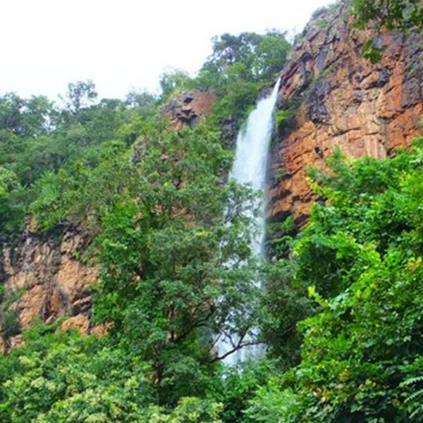
The district is approximately divided into two similar regions by NH-215. The eastern part of these divisions comprises the plains of Anandapur and a part of Sardar sub-division. In the west division, lie the hills that contain some of the highest peaks of Orissa like the Gandhamardan, Mankadnacha, Gonasika, and Thakurani.